Spectacle · Aurangabad, Maharashtra
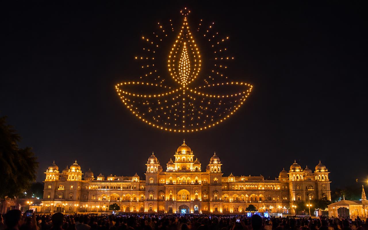
Drone Light Show in Aurangabad
In Aurangabad, industrial and dealer conferences for the midc belt set the standard everything else is measured against. Our drone light shows is specified to clear that bar at Rama International and anywhere else in the city.
- Lead time
- From 10 weeks
- Peak season
- Oct–Feb
- Coverage
- Aurangabad & Maharashtra
Key takeaway
Drone Light Shows for Aurangabad’s biggest events
A drone light show is a choreographed flight, and the choreography is written in three dimensions against hard safety envelopes. Each aircraft is a small multirotor in the sub-kilogram class carrying a single high-output RGBW LED module. Positioning is GNSS-based, augmented by an RTK base station on site that corrects satellite error down to roughly centimetre-level accuracy — without RTK, formations of several hundred drones cannot hold the tight spacing that makes a logo readable. Flight paths are designed in show software, collision-checked in simulation, then uploaded to each aircraft which flies its own pre-loaded trajectory rather than being joysticked live.
What matters here is the sky and the ground beneath it: an unobstructed viewing axis, a clear flight volume with no tall structures or trees, and an audience position outside the buffer. In Aurangabad that plays out at venues like Rama International, Vivanta Aurangabad, Prozone grounds, and across CIDCO, Jalna Road, Osmanpura, Beed Bypass.
Permission is the critical path, not the content. Indian drone operations fall under the Drone Rules 2021 administered by the DGCA through the Digital Sky platform, with the airspace map dividing the country into green, yellow and red zones. A show of this kind needs registered aircraft with UINs, a certified remote pilot, operation inside a defined and approved volume, and — because a swarm show is flown beyond the pilot's ability to see and control each unit individually — specific permission for the operating concept, plus night-operation clearance. Any site near an aerodrome falls into controlled airspace and needs ATC coordination. We open the permission file the day the booking is confirmed because clearances take weeks, not days.
What’s included
- 100 – 1,000+ synchronized drones
- Custom 3D animation & logo reveals
- DGCA-compliant operations & permissions
- Music-synced, 8–15 minute shows
Equipment we carry
Why Aurangabad chooses Prime AV
- Crews and trucks positioned for fast load-in at Prozone grounds and venues in Osmanpura and Beed Bypass.
- We check the Digital Sky airspace map against the exact coordinates before quoting, and where the site is marginal we identify an alternative launch position within sightline of the audience.
- Flight plan and collision-simulation report for the full fleet
- Working knowledge of Maharashtra venue rules, power sanctions and permission timelines.
Local conditions
Producing drone light show in Aurangabad
Weather & the rig
Wind decides whether a drone show flies at all — most light-show platforms stop at around 8 metres per second sustained, and rain is an outright no-fly, so the local weather pattern sets the date as much as the calendar does. Marathwada is a drought-prone rain-shadow region, and the practical consequence for production is unusual: water for dust suppression has to be sourced and paid for as a line item, which is not true of any other city in this set. Summers reach 41–42°C with dry heat and a fine basalt dust that fouls filters. Winter nights at 10–12°C on the plateau are dry and clear, which makes the October to February window genuinely dependable for outdoor work. Jun–Sep monsoon, though Marathwada's rainfall is erratic enough that the greater planning risk in Apr–May is water availability and heat rather than rain.
Power & redundancy
A drone show needs comparatively little power but needs it reliably, because hundreds of battery sets have to be charged and cycled on site between a rehearsal flight and the show. MSEDCL supply across the Waluj and Shendra MIDC belt is industrial-grade and stable, so a plant event can run on the factory's own feed with a changeover. Rural and heritage-adjacent venues towards Ellora sit on weaker feeders and need DG as the primary source. Maharashtra's acoustic enclosure requirement and the 10pm cut apply, enforced by MPCB.
Permits & noise rules
Drone shows live or die on airspace clearance, so we start the permission file the day you book. The municipal corporation grants ground and structure permission and the city police commissionerate licenses loudspeakers and gatherings, with MPCB applying the noise standards. The decisive layer for anything on the heritage circuit is the Archaeological Survey of India, which controls Ajanta, Ellora, Bibi Ka Maqbara and Daulatabad — no structures, fixings, amplified sound or drones within the protected limits without permission, and Ajanta specifically restricts lighting anywhere near the painted caves because of the conservation risk. Chikalthana airport sits inside the city, narrowing the usable drone airspace.
Load-in & access
The launch grid needs a flat, sterile, vehicle-accessible area of up to 100 metres square that stays clear of guests for the whole evening, which is often harder to find than the sky above it. The Samruddhi Mahamarg has transformed access: Mumbai is now around six hours and Nagpur similar, where both used to be a full day, so metro-grade inventory can reach the city on an overnight run. Jalna Road and the Beed Bypass take large trucks. The walled old city around Gulmandi, City Chowk and the historic gates is tight, and the runs out to Ellora at 30km and Ajanta at 100km are on roads that a 32-ft truck travels slowly.
Season & booking
The Ellora-Ajanta Aurangabad Festival runs in the winter months and takes local staging and sound. The October to February tourist high season fills the hotels, which compresses crew accommodation and raises its cost at exactly the time the wedding and conference seasons peak. Ganesh Chaturthi and Dussehra bring the MIDC townships' own mandal events. Peak demand runs Oct–Feb.
Crew & dispatch
Served from the Mumbai base over the Samruddhi expressway in about six hours, with Pune as an alternative origin, and local labour, DG and water tankers arranged in the city. Load-in support covers Osmanpura, Beed Bypass and the rest of the city.
What it costs here
MIDC clients buy to a corporate standard and will pay for documented reliability on a dealer conference, while local social events are price-sensitive. The honest framing is that the Samruddhi link has cut the travel loading this market used to carry, and the saving should show in the quotation.
Local expectations
Plant and dealer events here are safety-governed in a way social-events suppliers consistently get wrong: permit-to-work discipline, hot-work clearance for any rigging inside a plant, height-work certification and PPE compliance for every crew member are prerequisites for entry, not preferences. Marathi compering with Hindi for visiting dealers. Heritage-circuit MICE expects a cultural evening with classical or Marathwada folk programming and the restrained production a monument setting demands.
Specification
Drone Light Shows: technical specification
| Specification | Detail |
|---|---|
| Fleet size | 100 – 1,000+ aircraft, scaled to the figure complexity required |
| Positioning | GNSS with on-site RTK base station, approximately centimetre-level accuracy |
| Aircraft class | Sub-1 kg multirotor with a single high-output RGBW LED module |
| Flight duration | 8 – 15 minutes per battery set, extended by staged launches |
| Flight volume | Typically 120 – 180 m above ground inside an approved and geofenced volume |
| Wind limit | Approximately 8 m/s sustained, with a lower documented gust ceiling |
| Audience separation | A buffer zone with no audience beneath the formation at any point |
| Regulatory framework | DGCA Drone Rules 2021, Digital Sky registration, UINs, certified remote pilot |
| Airspace | Green-zone siting preferred; yellow zone and near-aerodrome sites need ATC coordination |
| Fail-safes | Hard geofence, automatic return-to-launch, redundant radio link and an all-stop command |
On the ground, the show is a safety operation. A launch grid is laid out with fixed spacing per aircraft, surveyed and marked. A geofence is programmed as a hard boundary: aircraft that drift outside it are commanded to land or return automatically, and a separate buffer separates the flight volume from the audience, which never sits underneath the formation. Wind is the binding environmental limit — most light-show platforms are rated to roughly 8 metres per second sustained, with gust limits lower, and we hold a documented go/no-go wind figure. Rain is a hard stop. Every show carries a return-to-launch and an all-stop command on a redundant radio link.
Sizing
What size rig does your event actually need?
| Scale | Guests | Recommended setup |
|---|---|---|
| Private reveal | 100 – 500 | 100 – 150 drones, 6 formations, readable text up to about 12 characters, 80 m x 80 m launch grid |
| Wedding spectacle | 500 – 1,500 | 200 – 300 drones, 8 – 10 formations, two names plus a 3D ring, 120 m flight ceiling |
| Brand launch | 1,500 – 5,000 | 400 – 500 drones, logo with gradient fill and a product morph, 150 m ceiling |
| City festival | 10,000 – 50,000 | 700 – 1,000 drones, narrative sequence with script text, staged launches, 180 m ceiling |
| Civic landmark show | 50,000+ | 1,000+ drones, dual ground stations, redundant fleet, full ATC-coordinated volume |
Scope
Drone Light Show scope tiers in Aurangabad
Signature Reveal
Weddings and private reveals, 100 – 200 drones, 6 – 8 minute show
- Up to six formations including names, a logo and a heart or ring motif
- RTK-corrected flight with full geofencing and automatic return-to-launch
- DGCA permission file, UIN-registered fleet and a certified remote pilot
- Music-synced show with a mixed audio track
- Launch grid survey, safety marshals and ground crew
Brand Spectacle
Product launches and corporate events, 250 – 500 drones, 8 – 12 minutes
- Ten to fifteen formations with 3D animated transitions and a product morph
- Bespoke 3D choreography designed and collision-simulated in show software
- Full airspace file including ATC coordination where the site requires it
- Original score or licensed track with timecoded synchronisation
- Backup aircraft pool and a rehearsal flight the night before
Festival & Civic Show
City festivals and government events, 600 – 1,000+ drones, 12 – 15 minutes
- Narrative show across twenty-plus formations with text in multiple scripts
- Staged multi-battery launches for extended runtime
- Full permission package including police, district and airspace clearances
- On-site weather station with a documented go/no-go decision protocol
- Full flight operations team, dual ground control stations and medical standby
MIDC clients buy to a corporate standard and will pay for documented reliability on a dealer conference, while local social events are price-sensitive. The honest framing is that the Samruddhi link has cut the travel loading this market used to carry, and the saving should show in the quotation.
Venues
Where we work in Aurangabad
| Venue | Capacity | Production note |
|---|---|---|
| Rama International | Several hundred banquet plus lawns at Chikalthana | On the airport road with straightforward highway truck access, which makes it the city's simplest large load-in and the practical base for a fly-in dealer meet. |
| Vivanta Aurangabad | Several hundred across banquet space and gardens | Heritage-style gardens where mature planting and the property's own guest-amenity rules dictate where towers and generators may stand, which usually means longer cable runs than the drawing assumed. |
| Prozone grounds | Several thousand on open ground beside the mall | Flat and well-connected but generated end to end, with Marathwada's fine basalt dust needing suppression and matting — and water for that suppression is itself a scarce, costed input in this district. |
| Tapadiya Natya Mandir | Around 1,000 seated | A traditional theatre with fixed seating and house rigging, where the build window between programmes is short and the proscenium geometry fixes the screen position. |
| MGM Rukmini Auditorium | Around 1,200 seated | A campus auditorium with institutional approvals and a vehicle gate process, used heavily for convocations and cultural programming in the winter months. |
Crew
Who turns up on show day
- Remote pilot in command
Holds the DGCA certification and the legal authority for the flight, makes the go/no-go call and owns the all-stop.
- Show designer
Builds the 3D choreography, runs collision simulation and times every formation transition to the audio.
- Ground control operator
Runs the ground station, monitors telemetry and battery state across the fleet and triggers the launch sequence.
- RTK and comms technician
Sets up and verifies the RTK base station and the redundant radio link, and watches link margin throughout.
- Launch grid crew
Surveys and marks the grid, places and powers every aircraft, and recovers them in order after landing.
- Safety marshal
Holds the audience buffer, keeps the launch and landing zone sterile and reports any incursion to the pilot immediately.
What you receive
- DGCA and Digital Sky permission documents with the approved flight volume
- Approved storyboard with every formation rendered in sequence
- Flight plan and collision-simulation report for the full fleet
- Launch grid survey drawing with aircraft positions and spacing
- Geofence and emergency procedure document including the all-stop protocol
- Timecoded show audio master used for synchronisation
- Aerial and ground video capture of the show as flown
Timeline
From enquiry to load-out
- T-10 weeks
Airspace and site assessment
We check the Digital Sky airspace map for the site, identify zone classification and aerodrome proximity, and confirm feasibility before anything is promised.
- T-8 weeks
Permission file submission
DGCA and Digital Sky filings, UIN verification, pilot certification, ATC coordination where required, plus police and district permissions.
- T-6 to T-3 weeks
Choreography and simulation
Formations designed in show software, collision-checked in simulation, and the storyboard approved with the client.
- Show day −2
Site build and grid survey
Launch grid surveyed and marked, RTK base established, geofence programmed and the flight volume walked.
- Show day −1
Rehearsal flight
A full or partial flight at the show hour to verify positioning, link margin, lighting levels and audio sync.
- Show day to +3 hours
Show and recovery
Final weather call, launch, show, landing in sequence, then grid recovery, battery management and fleet inspection.
Risk control
What goes wrong, and how we stop it
What can go wrong
How we prevent it
- What can go wrong
The venue turns out to be inside controlled airspace near an aerodrome and the show cannot legally fly.
How we prevent itWe check the Digital Sky airspace map against the exact coordinates before quoting, and where the site is marginal we identify an alternative launch position within sightline of the audience.
- What can go wrong
Wind on the night exceeds the platform limit and the client expects the show to fly anyway.
How we prevent itA numeric go/no-go wind figure is written into the contract, an on-site weather station logs the reading, and a contingency slot on the following night is agreed at booking.
- What can go wrong
GNSS positioning drifts and a 300-drone logo reads as a blur rather than a shape.
How we prevent itAn RTK base station on site corrects satellite error to centimetre-level, and the rehearsal flight verifies formation tightness from the actual audience viewing position.
- What can go wrong
Text in a logo or a name is unreadable because the fleet is too small for the character count.
How we prevent itCharacter legibility is calculated against fleet size and viewing distance at the design stage, and we reduce the character count or raise the drone count rather than flying something illegible.
Honest comparison
Is this the right choice for your event?
- Fireworks instead of a drone showOur verdict
Fireworks are cheaper, louder and far easier to permit in most places, and nothing matches the physical shock of a shell. Drones win on precision — logos, names, product shapes — on reusability, on noise, on smoke and on sites where open flame is forbidden. Many clients do both, with drones for the story and a short pyro finale.
- A smaller fleet to save budgetOur verdict
Sometimes correct. At 100 to 150 drones you get clean simple shapes and short text, which is plenty for a wedding reveal. It becomes a false economy when the brief includes a detailed logo or long names, because the shape simply will not resolve.
- Projection mapping instead of a drone showOur verdict
Mapping needs a surface and gives you detail, texture and narrative at a lower per-minute cost. A drone show needs sky and gives you scale and the surprise of looking up. If the venue has a façade, map it; if it has an open horizon, fly.
Demand
What Aurangabad books most
Aurangabad event mix
- Industrial and dealer conferences for the MIDC belt
- Heritage-circuit MICE and incentive programmes
- Weddings across the CIDCO and Jalna Road belt
- Vendor and supplier exhibitions
- Educational institution events and convocations
- Cultural festivals and classical programming
Ideal for
Events we power with drone light shows in Aurangabad
Process
From brief to standing ovation
01
Brief & recce
We visit the venue, map power and rigging, and understand your show flow.
02
Design & quote
CAD plans, 3D previews and an itemised quote within 24 hours.
03
Build & rehearse
Load-in, system tuning, content checks and full technical rehearsal.
04
Show & strike
Show-caller-led execution, then a quick, clean load-out.
FAQ
Drone Light Show in Aurangabad: FAQs
More services in Aurangabad
Drone Light Show in nearby cities
Areas we cover in Aurangabad
Events in Aurangabad